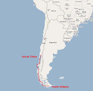
 How to describe this incredible two-month sailing journey from Puerto Williams through the Patagonian channels to Chiloe? I'll try to put it into words, then you'll just have to see the photos that follow...
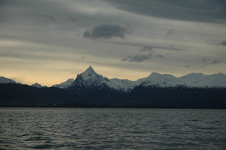
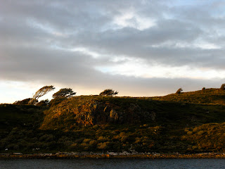
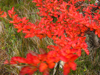
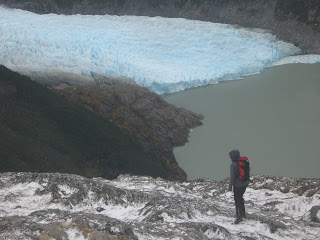
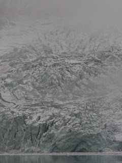
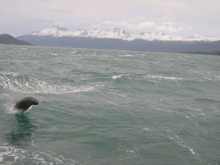
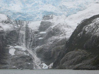
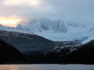
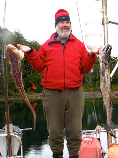
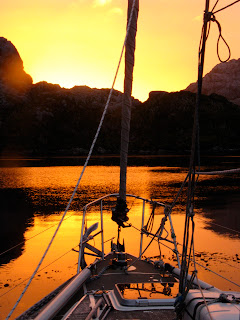
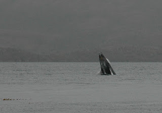
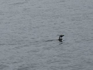
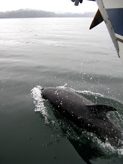
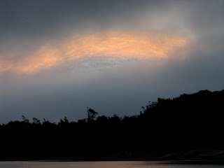
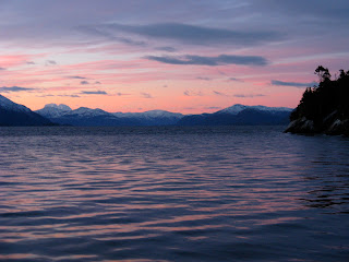
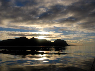
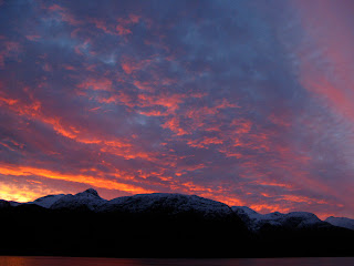
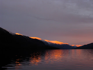
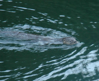
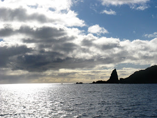
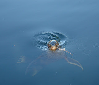
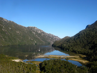
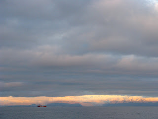
Beautiful, desolate, scenery mostly in grey scale – from black sea to granite islands to white snow and glaciers – with the occasional rainbow and blue skies, and plenty of glorious suns rising and setting. Exceptional wildlife welcoming and bidding us farewell from many anchorages, including dolphins, otters, seals, penguins, humpback and minke whales, kelp geese, steamer ducks, albatrosses, and storm petrels.
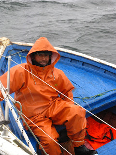
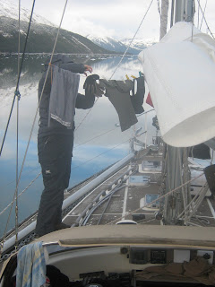
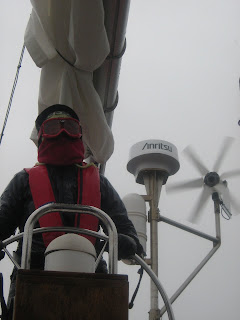
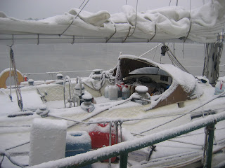
Cold! Most days, I wore three pairs of long underwear, my cycling pants and waterproof overpants, and on my upper half a similar 5-layer system. At times I wore two toques, and I can count the instances on one hand when it was warm enough to have a bare head, including while inside the boat. When we were sailing into the wind and rain, being at the helm could be painful. It seemed like it always started to hail just when it was my turn! Everyone on board had varying degrees of ‘trench foot’. We were able to have hot showers on the boat only six times, and I did laundry twice. We adopted the old saying, “nobody smells on a submarine”. Because clean and warm were fleeting luxuries, it was even more delightful when we found some natural hotsprings just north of the Golfo de Penas!
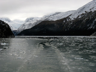
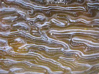
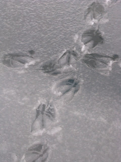
In some of the fjords that led up to glaciers that spilled down from the southern ice field, there were mini icebergs that had calved off the glaciers and were floating in the water. At times, there were so many that we had to carefully weave our way through them. A few times, we saw the surface few millimeters of the ocean freeze, because it was freshwater floating on top of the saltwater. In one anchorage, there were bird prints crisscrossing the thin layer of ice!
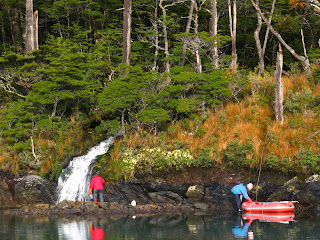
Filling the freshwater tanks was always fun, but never easy. Generally, one person stayed at a waterfall filling 5L bottles, while another person was in the dinghy, ferrying the jugs to a third person on the boat, who poured them into the tank, while the fourth person was at the helm, keeping the boat as close to land as possible without running aground. It certainly made us think about exactly how much water we used every time we were at the sink!
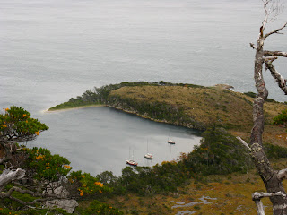
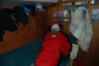
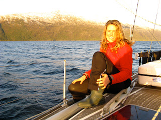
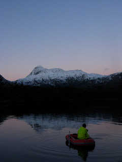
Sunset around 6:00pm every night. Evenings of huge plates of food, cards (always Uno, Frank’s favourite game) or a movie and early to bed in order to get an early start. Patricia and I putting our beds away every morning (they became the dining/living room) and bringing them out every night, and having to wriggle in and out of our clothes inside our mummy bags for lack of privacy. All four of us were always within 40 feet of each other, but more often within 10, with nowhere to go to really be alone. We were able to get off the boat about six times to go hiking. We definitely got to know all sides of each other very well!
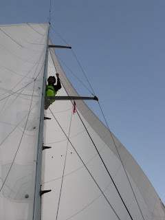
We sailed every day that the weather allowed, which in the Beagle channel and Magellan straits was, on average, only every second day. We were almost always sailing into the prevailing winds, so when it was windy, we were crashing headlong into waves and sometimes making good only about 10 miles in a 10 hour day – several days, we gave up and just headed back to the same anchorage.
As we got further north, the going got easier and we even had the wind behind us half a dozen times. This meant covering 50 miles or so in a day with relatively little effort, and reaching speeds of over 8 knots. In reality, that’s only 15km/hour but on a boat it feels like you’re flying! We sailed into the dark twice in order to reach a safe anchorage, and twice we sailed overnight to cross a gulf, but otherwise we were safely stowed in a beautiful little bay by nightfall.
Because of the strong gusty ‘williwas’ and small size of the anchorages, we generally dropped anchor, backed up towards lands, then one person rowed furiously to shore in the dinghy to tie lines to trees, to keep us from blowing around too much. In the morning, we did it all in reverse.
When we were stuck somewhere because of weather, we did lots of reading. Frank has an extensive collection of books about sailing, especially in that part of the world, so we read about Cook, Darwin, Shackleton, Drake, Magellan, Fitzroy, the shipwrecked crew of the Wager, Milward, Tilman, and Slocum. It was a little weird to realize that there are actually fewer people in the channels now than 100 years ago, due to the opening of the Panama Canal and the genocide of most of the original inhabitants, through both quick and more drawn out means. The Aonikenk and Shelknam are completely gone, while there is about nine Kawashkar people in Puerto Eden and seven Yamana in Puerto Williams. Ironically, the word ‘yamana’ as a verb means “to live, breathe, be happy, recover from sickness or be sane”.
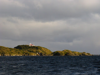
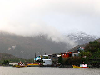
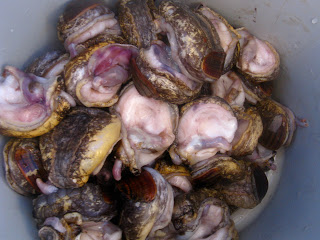
After our first week at sea, we met only two other sailboats, both going the other way, and our only other conversations were with local fisherman, with whom we traded various treats for fish and shellfish. We would call up the lighthouses as we went by to report in, and they were always really friendly and up for a little chat. We stopped in only one town, Puerto Eden, which has about 200 inhabitants. The town clings to a hillside around a little bay and there are no roads. Instead the buildings are joined by wooden walkways and stairs – it snowed while we were there, so it got a pretty slippery!
You can tell from reading the marine charts what the first European sailors thought of this area. A selection of the names that were given:
Isla Desolacion (Desolation Island)
Bahia Inutil (Useless Bay)
Canal Icy (Icy Channel)
Canal Escape
Seno Iceberg (Iceberg Sound)
Punta (Point) Chill
Isla Riesgo (Risk Island)
Paso Tortuoso (Tortuous Pass)
Isla Furia (Fury Island)
Punta Solitaria (Solitary Point)
Seno Nevado (Snowstorm Sound)
Poca Esperanzo Estero (Little Hope Sound)
Estero Ultima Esperanza (Last Hope Straight)
Isla Deceit
Islotes Anxious (Anxious Islands)
Bajo Inconveniente (Inconvenient Shallows)
Golfo de Penas (Gulf of Sorrows)
Bahia Fatal (Fatal Bay)
Bahia Desangano (Disappointment Bay)
Paso del Abismo (Abysmal Pass)
Luckily for us, we had those charts and a whole lot more comforts than the old sailing ships, so it wasn’t quite as bad. Definitely worth it for all the amazing things we saw. All in all, it was an amazing adventure that I’m glad I had. I’m happy to be back in Santiago, though, where it is apparently winter, but incredibly warm and dry to me!
Nelson finishes school in a week, when we will head north to Bolivia and Peru for three weeks before returning to Canada.

 After Nelson finished his semester in Santiago, we headed north to Peru and Bolivia for one last hurrah before returning to Canada. In doing so, we learned a lot about Inca culture like what kind of cola they drank, what they wore under those robes, their extensive use of aquaducts, and how they told time. They used the shadow of these perfectly carved little stone pillars to not just tell time each day, but also to determine exactly when to plant their crops each year.


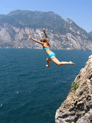
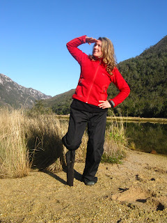
 The Incas loved the mountains, and were in great shape from hiking very steep trails between their cities located in extremely inaccesible, but really beautiful, locations. We did a 7-day hike that took us first to one ancient city - Choquequirao, thought to be where the Incas in Cusco fled when under attack by the Spanish - past some other ruins that were being restored, some modern little mountain villages, and finally to Machu Picchu. Many parts of the trail included ancient rock steps created by the Inca, and we went over two high passes at 4200m and 4650 - the photo of me with the big snowy mountain behind is now, officially, the highest I've ever been. As we sat at the pass eating lunch, condors flew by below us.


 Nearing Machu Picchu, we hiked through a lot of coffee growing beside the trail. We also saw the cement structures where they dry the coffee pods, the little machine they use to husk them, and the raw white beans drying further in the sun.


 Machu Picchu itself wasn't necessarily the highlight of the trip, but it was icing on the cake after such a wonderful week of hiking. The stone work is really impressive. It is not for those with bad knees or vertigo, though!


 Modern Peruvian culture has retained some aspects from the Incan epoch. A lot of the house construction is mud brick and they use the Inca Kola bottles to make pipes to transport water. I don't think the Incas wore bowler hats and had bicycle taxis, though. And how long have people in that area been eating guinea pigs? Despite seeing a picture of a guinea pig with the caption "look into my eyes, do you really want to eat me?", Nelson tried this traditional dish. We also learned to play a Peruvian game called "sapo" where you try to toss gold coins in the mouth of a gold frog. To round out the experience, we tried coca leaves - in both tea and jam form. My favourite Peruvian food experience, though, was the women in the market in Cusco who make you a blender full of juice from whichever combination of fruits you pick out. I drank two blenders full in one sitting.


 We visited Bolivia, as well, taking a boat out to the Isla del Sol on Lake Titicaca as well as visiting La Paz, and a cute little mountain town called Sorata. We felt like we didn't have enough time to see everything we wanted, and almost moved our flights back a few weeks. Then we realized that we would probably never feel like we had seen everything we wanted and that we should leave while we were still having fun.
 It was a good decision. It's great to be back home.